
Villers-le-Temple topographic map
Interactive map
Click on the map to display elevation.
About this map
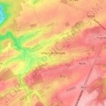
Name: Villers-le-Temple topographic map, elevation, terrain.
Location: Villers-le-Temple, Nandrin, Huy, Liège, Wallonia, 4550, Belgium (50.48811 5.35084 50.52811 5.39084)
Average elevation: 237 m
Minimum elevation: 143 m
Maximum elevation: 278 m
Other topographic maps
Click on a map to view its topography, its elevation and its terrain.
Borset
Belgium > Liège > Huy > Vaux-et-Borset
Borset, Vaux-et-Borset, Villers-le-Bouillet, Huy, Liège, Wallonia, 4530, Belgium
Average elevation: 175 m