
Thank you for supporting this site ❤️
Make a donation
Make a donation
Zorn topographic map
Click on the map to display elevation.
Thank you for supporting this site ❤️
Make a donation
Make a donation
About this map
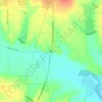
Name: Zorn topographic map, elevation, terrain.
Location: Zorn, Guadalupe County, Texas, United States (29.73300 -97.96806 29.77300 -97.92806)
Average elevation: 169 m
Minimum elevation: 147 m
Maximum elevation: 200 m
Thank you for supporting this site ❤️
Make a donation
Make a donation
Other topographic maps
Click on a map to view its topography, its elevation and its terrain.