
Thank you for supporting this site ❤️
Make a donation
Make a donation
Bhulbhule topographic map
Click on the map to display elevation.
Thank you for supporting this site ❤️
Make a donation
Make a donation
About this map
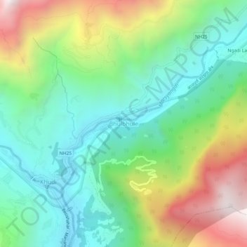
Name: Bhulbhule topographic map, elevation, terrain.
Location: Bhulbhule, Marsyangdi, लमजुङ, Provinz Gandaki, 36000, Nepal (28.27039 84.35151 28.31039 84.39151)
Average elevation: 1,257 m
Minimum elevation: 760 m
Maximum elevation: 2,213 m
Thank you for supporting this site ❤️
Make a donation
Make a donation