
Pampilla topographic map
Interactive map
Click on the map to display elevation.
About this map
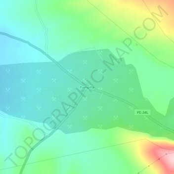
Name: Pampilla topographic map, elevation, terrain.
Location: Pampilla, Ananea, San Antonio de Putina, Puno, Pérou (-14.68700 -69.59049 -14.64700 -69.55049)
Average elevation: 4,605 m
Minimum elevation: 4,546 m
Maximum elevation: 4,771 m