
Thank you for supporting this site ❤️
Make a donation
Make a donation
Constitution Hill topographic map
Click on the map to display elevation.
Thank you for supporting this site ❤️
Make a donation
Make a donation
About this map
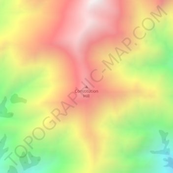
Name: Constitution Hill topographic map, elevation, terrain.
Location: Constitution Hill, Kaikōura, Canterbury, New Zealand (-42.09083 173.54478 -42.09073 173.54488)
Average elevation: 1,566 m
Minimum elevation: 869 m
Maximum elevation: 2,150 m
Canterbury trails, hiking, mountain biking, running and outdoor activities
Thank you for supporting this site ❤️
Make a donation
Make a donation