
Thank you for supporting this site ❤️
Make a donation
Make a donation
Clark topographic map
Click on the map to display elevation.
Thank you for supporting this site ❤️
Make a donation
Make a donation
About this map
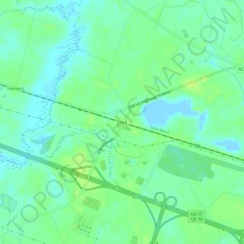
Name: Clark topographic map, elevation, terrain.
Location: Clark, Craven County, North Carolina, United States (35.12599 -77.17995 35.16599 -77.13995)
Average elevation: 7 m
Minimum elevation: -11 m
Maximum elevation: 15 m
Thank you for supporting this site ❤️
Make a donation
Make a donation
Other topographic maps
Click on a map to view its topography, its elevation and its terrain.