
Thank you for supporting this site ❤️
Make a donation
Make a donation
Port Ohope topographic map
Click on the map to display elevation.
Thank you for supporting this site ❤️
Make a donation
Make a donation
About this map
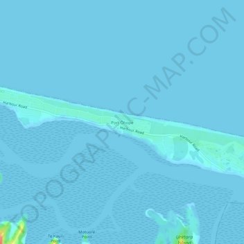
Name: Port Ohope topographic map, elevation, terrain.
Location: Port Ohope, Whakatane District, Bay of Plenty, New Zealand (-38.00185 177.08933 -37.96185 177.12933)
Average elevation: 1 m
Minimum elevation: 0 m
Maximum elevation: 59 m
Whakatane District trails, hiking, mountain biking, running and outdoor activities
Thank you for supporting this site ❤️
Make a donation
Make a donation
Other topographic maps
Click on a map to view its topography, its elevation and its terrain.