
Banaba Lejos topographic map
Interactive map
Click on the map to display elevation.
About this map
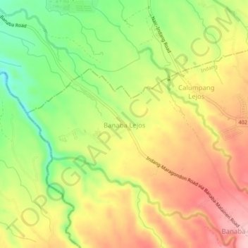
Name: Banaba Lejos topographic map, elevation, terrain.
Location: Banaba Lejos, Indang, Cavite, Calabarzon, 4122, Philippines (14.21175 120.81316 14.25175 120.85316)
Average elevation: 152 m
Minimum elevation: 65 m
Maximum elevation: 230 m