
Thank you for supporting this site ❤️
Make a donation
Make a donation
Wrightstown topographic map
Click on the map to display elevation.
Thank you for supporting this site ❤️
Make a donation
Make a donation
About this map
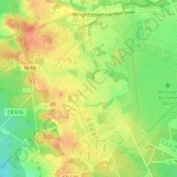
Name: Wrightstown topographic map, elevation, terrain.
Location: Wrightstown, Burlington County, New Jersey, United States (39.99250 -74.65725 40.04008 -74.60231)
Average elevation: 41 m
Minimum elevation: 19 m
Maximum elevation: 60 m
Thank you for supporting this site ❤️
Make a donation
Make a donation