
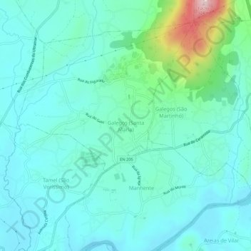
Galegos (Santa Maria) topographic map
Interactive map
Click on the map to display elevation.
About this map
Name: Galegos (Santa Maria) topographic map, elevation, terrain.
Location: Galegos (Santa Maria), Braga, 4750-744, Portugal (41.53877 -8.59746 41.57877 -8.55746)
Average elevation: 59 m
Minimum elevation: 3 m
Maximum elevation: 312 m