
Thank you for supporting this site ❤️
Make a donation
Make a donation
Daisy Mountain topographic map
Click on the map to display elevation.
Thank you for supporting this site ❤️
Make a donation
Make a donation
About this map
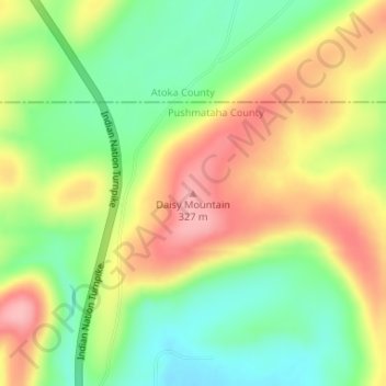
Name: Daisy Mountain topographic map, elevation, terrain.
Location: Daisy Mountain, Pushmataha County, Oklahoma, United States (34.50033 -95.72392 34.50043 -95.72382)
Average elevation: 259 m
Minimum elevation: 196 m
Maximum elevation: 331 m
Thank you for supporting this site ❤️
Make a donation
Make a donation
Other topographic maps
Click on a map to view its topography, its elevation and its terrain.