
Sunderland topographic map
Interactive map
Click on the map to display elevation.
About this map
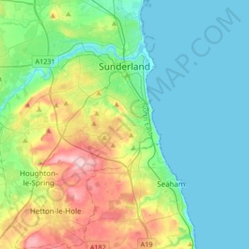
Name: Sunderland topographic map, elevation, terrain.
Location: Sunderland, Nordostengland, England, Vereinigtes Königreich (54.79904 -1.56888 54.94417 -1.34567)
Average elevation: 46 m
Minimum elevation: -2 m
Maximum elevation: 174 m