
Rouillié topographic map
Interactive map
Click on the map to display elevation.
About this map
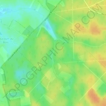
Name: Rouillié topographic map, elevation, terrain.
Average elevation: 148 m
Minimum elevation: 130 m
Maximum elevation: 165 m
Other topographic maps
Click on a map to view its topography, its elevation and its terrain.
Locquignol
France > Hauts-de-France > Locquignol > Locquignol
Locquignol, Avesnes-sur-Helpe, Nord, Hauts-de-France, France métropolitaine, 59530, France
Average elevation: 147 m