
Thank you for supporting this site ❤️
Make a donation
Make a donation
Pegarinhos topographic map
Click on the map to display elevation.
Thank you for supporting this site ❤️
Make a donation
Make a donation
About this map
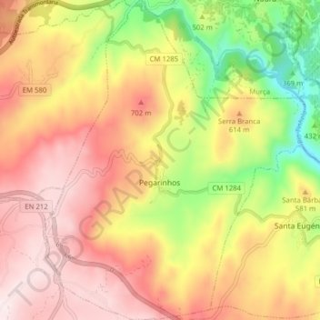
Name: Pegarinhos topographic map, elevation, terrain.
Location: Pegarinhos, Alijó, Vila Real, 5070-302, Portugal (41.33081 -7.47376 41.38955 -7.40979)
Average elevation: 557 m
Minimum elevation: 239 m
Maximum elevation: 805 m
Thank you for supporting this site ❤️
Make a donation
Make a donation
Other topographic maps
Click on a map to view its topography, its elevation and its terrain.