
Castro topographic map
Interactive map
Click on the map to display elevation.
About this map
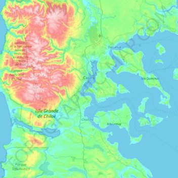
Name: Castro topographic map, elevation, terrain.
Location: Castro, Provincia de Chiloé, Región de Los Lagos, Chile (-42.69052 -74.19282 -42.35188 -73.37918)
Average elevation: 165 m
Minimum elevation: -1 m
Maximum elevation: 847 m