Geolocate

Cobb County topographic map

Interactive map

Click on the map to display elevation.

About this map

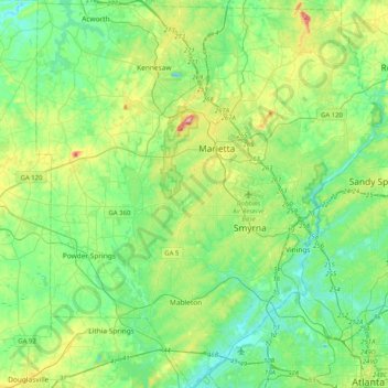
Name: Cobb County topographic map, elevation, terrain.

Location: Cobb County, Georgia, United States (33.74351 -84.73964 34.08178 -84.37473)

Average elevation: 301 m

Minimum elevation: 223 m

Maximum elevation: 529 m

Other topographic maps

Click on a map to view its topography, its elevation and its terrain.

Lake Royal

United States > Georgia > Columbia County

Average elevation: 122 m

Denmark

United States > Georgia > Bulloch County

Average elevation: 45 m

Waverly

United States > Georgia > Richmond County > Augusta

Average elevation: 96 m

Westwood

United States > Georgia > Richmond County > Augusta

Average elevation: 105 m

Brighton

United States > Georgia > Brighton

Average elevation: 109 m

McKinney

United States > Georgia > Upson County > McKinney

Average elevation: 224 m

Duluth

United States > Georgia > Duluth

Average elevation: 304 m