
Thank you for supporting this site ❤️
Make a donation
Make a donation
Ampara topographic map
Click on the map to display elevation.
Thank you for supporting this site ❤️
Make a donation
Make a donation
About this map
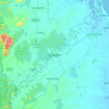
Name: Ampara topographic map, elevation, terrain.
Location: Ampara, Ampara District, Eastern Province, Sri Lanka (7.13781 81.51902 7.45781 81.83902)
Average elevation: 42 m
Minimum elevation: -1 m
Maximum elevation: 582 m
Thank you for supporting this site ❤️
Make a donation
Make a donation