
Town of Stuyvesant topographic map
Interactive map
Click on the map to display elevation.
About this map
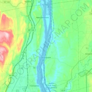
Name: Town of Stuyvesant topographic map, elevation, terrain.
Location: Town of Stuyvesant, Columbia County, New York, United States (42.34185 -73.79432 42.47036 -73.71846)
Average elevation: 68 m
Minimum elevation: -5 m
Maximum elevation: 273 m