
Thank you for supporting this site ❤️
Make a donation
Make a donation
Pukekaroro topographic map
Click on the map to display elevation.
Thank you for supporting this site ❤️
Make a donation
Make a donation
About this map
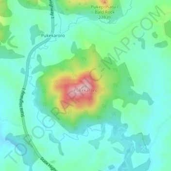
Name: Pukekaroro topographic map, elevation, terrain.
Location: Pukekaroro, Kaipara District, Northland, 0542, New Zealand (-36.13074 174.44226 -36.13064 174.44236)
Average elevation: 73 m
Minimum elevation: 11 m
Maximum elevation: 271 m
Kaipara District trails, hiking, mountain biking, running and outdoor activities
Thank you for supporting this site ❤️
Make a donation
Make a donation
Other topographic maps
Click on a map to view its topography, its elevation and its terrain.