Geolocate

Guiuan topographic map

Interactive map

Click on the map to display elevation.

About this map

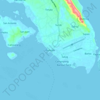
Name: Guiuan topographic map, elevation, terrain.

Location: Guiuan, Eastern Samar, Eastern Visayas, 6808, Philippines (10.99051 125.68381 11.07051 125.76381)

Average elevation: 6 m

Minimum elevation: -4 m

Maximum elevation: 118 m

Other topographic maps

Click on a map to view its topography, its elevation and its terrain.

Mercedes

Philippines > Eastern Samar

Mercedes, Eastern Samar, Eastern Visayas, 6808, Philippines

Average elevation: 11 m

Surok

Philippines > Eastern Samar

Surok, Eastern Samar, Eastern Visayas, 6808, Philippines

Average elevation: 17 m

Padang

Philippines > Eastern Samar

Padang, Eastern Samar, Eastern Visayas, 6804, Philippines

Average elevation: 26 m

Borongan

Philippines > Eastern Samar

Borongan, Eastern Samar, Eastern Visayas, 6800, Philippines

Average elevation: 109 m

Punta Maria

Philippines > Eastern Samar > Punta Maria

Punta Maria, Eastern Samar, Eastern Visayas, 06800, Philippines

Average elevation: 1 m

Linao

Philippines > Eastern Samar > Tikling

Linao, Tikling, Eastern Samar, Eastern Visayas, Philippines

Average elevation: 1 m

Eastern Samar

Philippines > Eastern Samar

Eastern Samar, Eastern Visayas, Philippines

Average elevation: 36 m