
Thank you for supporting this site ❤️
Make a donation
Make a donation
Amai Manabilang topographic map
Click on the map to display elevation.
Thank you for supporting this site ❤️
Make a donation
Make a donation
Amai Manabilang
Mountain ranges, hills, plateaus, and flatland characterize the topography of the barangay. It has a vast agricultural land suited for crops like rice, corn, carrots, sugar cane. Its hydrological features comprise rivers like the Maridugao and Sumogot, streams, swamps, creeks and springs.
Thank you for supporting this site ❤️
Make a donation
Make a donation
About this map
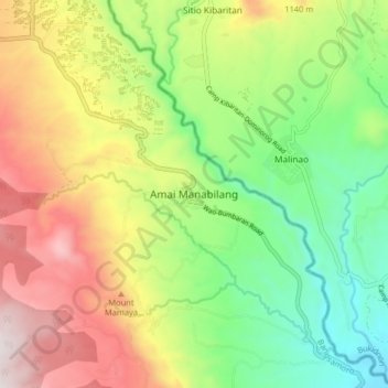
Name: Amai Manabilang topographic map, elevation, terrain.
Location: Amai Manabilang, Lanao del Sur, Bangsamoro, Philippines (7.74729 124.64186 7.82729 124.72186)
Average elevation: 969 m
Minimum elevation: 520 m
Maximum elevation: 1,577 m
Thank you for supporting this site ❤️
Make a donation
Make a donation
Other topographic maps
Click on a map to view its topography, its elevation and its terrain.