
Thank you for supporting this site ❤️
Make a donation
Make a donation
Ouddorp topographic map
Click on the map to display elevation.
Thank you for supporting this site ❤️
Make a donation
Make a donation
About this map
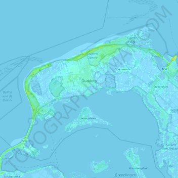
Name: Ouddorp topographic map, elevation, terrain.
Location: Ouddorp, Goeree-Overflakkee, South Holland, Netherlands (51.74769 3.77368 51.85813 3.99515)
Average elevation: 0 m
Minimum elevation: -4 m
Maximum elevation: 16 m
Thank you for supporting this site ❤️
Make a donation
Make a donation
Other topographic maps
Click on a map to view its topography, its elevation and its terrain.