
Watscha topographic map
Interactive map
Click on the map to display elevation.
About this map
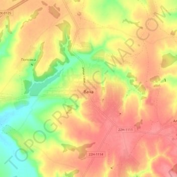
Name: Watscha topographic map, elevation, terrain.
Average elevation: 180 m
Minimum elevation: 123 m
Maximum elevation: 220 m
Other topographic maps
Click on a map to view its topography, its elevation and its terrain.
Watscha
Russland > Oblast Nischni Nowgorod > Watscha
Watscha, Вачский район, Oblast Nischni Nowgorod, Föderationskreis Wolga, 606150, Russland
Average elevation: 179 m