
Thank you for supporting this site ❤️
Make a donation
Make a donation
Lantana topographic map
Click on the map to display elevation.
Thank you for supporting this site ❤️
Make a donation
Make a donation
About this map
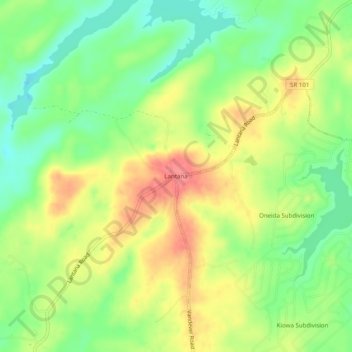
Name: Lantana topographic map, elevation, terrain.
Location: Lantana, Cumberland County, Tennessee, 38572, United States (35.85673 -85.12107 35.89673 -85.08107)
Average elevation: 583 m
Minimum elevation: 546 m
Maximum elevation: 624 m
Thank you for supporting this site ❤️
Make a donation
Make a donation
Other topographic maps
Click on a map to view its topography, its elevation and its terrain.