
Rheda-Wiedenbrück topographic map
Interactive map
Click on the map to display elevation.
About this map
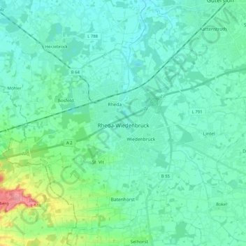
Name: Rheda-Wiedenbrück topographic map, elevation, terrain.
Average elevation: 80 m
Minimum elevation: 64 m
Maximum elevation: 157 m
The length of the city border is 50,2 km, the highest elevation at 105m and the lowest point at 66m above mean sea level.