
Thank you for supporting this site ❤️
Make a donation
Make a donation
Dunkirk topographic map
Click on the map to display elevation.
Thank you for supporting this site ❤️
Make a donation
Make a donation
About this map
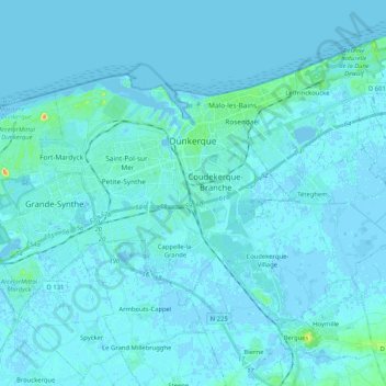
Name: Dunkirk topographic map, elevation, terrain.
Location: Dunkirk, Nord, Hauts-de-France, Metropolitan France, France (50.97598 2.23970 51.05810 2.44647)
Average elevation: 2 m
Minimum elevation: -4 m
Maximum elevation: 31 m
Thank you for supporting this site ❤️
Make a donation
Make a donation
Other topographic maps
Click on a map to view its topography, its elevation and its terrain.