
Thank you for supporting this site ❤️
Make a donation
Make a donation
Monroes Corner topographic map
Click on the map to display elevation.
Thank you for supporting this site ❤️
Make a donation
Make a donation
About this map
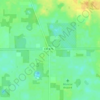
Name: Monroes Corner topographic map, elevation, terrain.
Location: Monroes Corner, Marion County, Florida, 34320, United States (29.01554 -82.12981 29.03554 -82.10981)
Average elevation: 25 m
Minimum elevation: 13 m
Maximum elevation: 42 m
Thank you for supporting this site ❤️
Make a donation
Make a donation
Other topographic maps
Click on a map to view its topography, its elevation and its terrain.
Thank you for supporting this site ❤️
Make a donation
Make a donation
Rainbow Springs State Park
United States > Florida > Marion County > Rainbow Falls
Average elevation: 21 m