
Tscheljabinsk topographic map
Interactive map
Click on the map to display elevation.
About this map
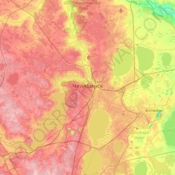
Name: Tscheljabinsk topographic map, elevation, terrain.
Average elevation: 230 m
Minimum elevation: 147 m
Maximum elevation: 297 m
Other topographic maps
Click on a map to view its topography, its elevation and its terrain.
Central District
Russland > Oblast Tscheljabinsk > Stadtkreis Tscheljabinsk > Tscheljabinsk
Central District, Tscheljabinsk, Stadtkreis Tscheljabinsk, Oblast Tscheljabinsk, Föderationskreis Ural, Russland
Average elevation: 239 m