
Thank you for supporting this site ❤️
Make a donation
Make a donation
Belmopan topographic map
Click on the map to display elevation.
Thank you for supporting this site ❤️
Make a donation
Make a donation
Belmopan
Belmopan is located in Cayo District at an altitude of 76 metres (249 feet) above sea level. Belmopan was constructed just to the east of the Belize River, 80 km (50 mi) inland from the former capital, the port of Belize City, after that city's near destruction by Hurricane Hattie in 1961. The government was moved to Belmopan in 1970. Its National Assembly Building is designed to resemble a Pre-Columbian Maya temple.
Thank you for supporting this site ❤️
Make a donation
Make a donation
About this map
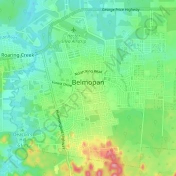
Name: Belmopan topographic map, elevation, terrain.
Location: Belmopan, Cayo District, Belize (17.21909 -88.79964 17.27679 -88.73089)
Average elevation: 61 m
Minimum elevation: 22 m
Maximum elevation: 171 m
Thank you for supporting this site ❤️
Make a donation
Make a donation