
Spoleto topographic map
Interactive map
Click on the map to display elevation.
About this map
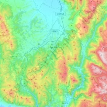
Name: Spoleto topographic map, elevation, terrain.
Location: Spoleto, Perugia, Umbrië, 06049, Italië (42.59682 12.55810 42.84304 12.84654)
Average elevation: 635 m
Minimum elevation: 205 m
Maximum elevation: 1,675 m
Other topographic maps
Click on a map to view its topography, its elevation and its terrain.