
Thank you for supporting this site ❤️
Make a donation
Make a donation
Hampden (CDP) topographic map
Click on the map to display elevation.
Thank you for supporting this site ❤️
Make a donation
Make a donation
About this map
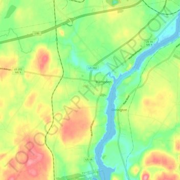
Name: Hampden (CDP) topographic map, elevation, terrain.
Location: Hampden (CDP), Penobscot County, Maine, United States (44.69769 -68.87062 44.78339 -68.78128)
Average elevation: 45 m
Minimum elevation: -5 m
Maximum elevation: 105 m
Thank you for supporting this site ❤️
Make a donation
Make a donation
Other topographic maps
Click on a map to view its topography, its elevation and its terrain.