
Aylesford topographic map
Interactive map
Click on the map to display elevation.
About this map
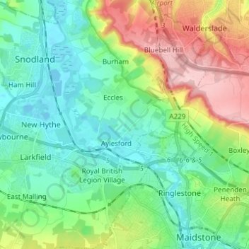
Name: Aylesford topographic map, elevation, terrain.
Location: Aylesford, Tonbridge and Malling, Kent, England, United Kingdom (51.27112 0.45658 51.34764 0.52675)
Average elevation: 60 m
Minimum elevation: -4 m
Maximum elevation: 198 m
Other topographic maps
Click on a map to view its topography, its elevation and its terrain.
Pratling Street
United Kingdom > England > Kent > Tonbridge and Malling > Aylesford > Pratling Street
Average elevation: 49 m