
Parque Nacional Pan de Azúcar topographic map
Interactive map
Click on the map to display elevation.
About this map
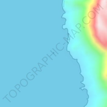
Name: Parque Nacional Pan de Azúcar topographic map, elevation, terrain.
Average elevation: 56 m
Minimum elevation: 0 m
Maximum elevation: 531 m
Other topographic maps
Click on a map to view its topography, its elevation and its terrain.
Isla Pan de Azúcar
Chile > Región de Atacama > Chañaral
Isla Pan de Azúcar, Chañaral, Región de Atacama, Chile
Average elevation: 5 m