
Oodweyne District topographic map
Interactive map
Click on the map to display elevation.
About this map
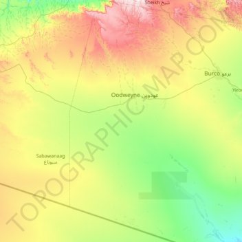
Name: Oodweyne District topographic map, elevation, terrain.
Location: Oodweyne District, Togdheer, Somalia (8.57202 44.69000 9.94019 45.29000)
Average elevation: 1,091 m
Minimum elevation: 767 m
Maximum elevation: 1,900 m