
Thank you for supporting this site ❤️
Make a donation
Make a donation
Amoeiro topographic map
Click on the map to display elevation.
Thank you for supporting this site ❤️
Make a donation
Make a donation
About this map
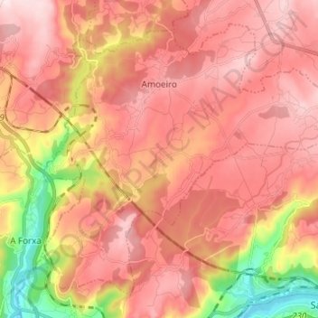
Name: Amoeiro topographic map, elevation, terrain.
Location: Amoeiro, Ourense, Galicia, España (42.35414 -7.99334 42.43139 -7.87098)
Average elevation: 348 m
Minimum elevation: 87 m
Maximum elevation: 500 m
Thank you for supporting this site ❤️
Make a donation
Make a donation
Other topographic maps
Click on a map to view its topography, its elevation and its terrain.