
Thank you for supporting this site ❤️
Make a donation
Make a donation
Langerwehe topographic map
Click on the map to display elevation.
Thank you for supporting this site ❤️
Make a donation
Make a donation
About this map
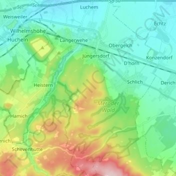
Name: Langerwehe topographic map, elevation, terrain.
Location: Langerwehe, Kreis Düren, North Rhine-Westphalia, 52379, Germany (50.75648 6.29851 50.83550 6.41830)
Average elevation: 183 m
Minimum elevation: 110 m
Maximum elevation: 370 m
Thank you for supporting this site ❤️
Make a donation
Make a donation
Other topographic maps
Click on a map to view its topography, its elevation and its terrain.