
Thank you for supporting this site ❤️
Make a donation
Make a donation
Panchase topographic map
Click on the map to display elevation.
Thank you for supporting this site ❤️
Make a donation
Make a donation
About this map
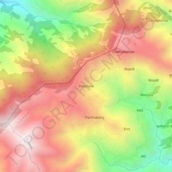
Name: Panchase topographic map, elevation, terrain.
Location: Panchase, Pachhawang, Duikholi, रोल्पा, Provinz Lumbini, Nepal (28.50988 82.46433 28.54988 82.50433)
Average elevation: 2,151 m
Minimum elevation: 1,449 m
Maximum elevation: 2,705 m
Thank you for supporting this site ❤️
Make a donation
Make a donation