
Rolleston topographic map
Click on the map to display elevation.
About this map
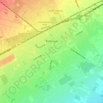
Name: Rolleston topographic map, elevation, terrain.
Location: Rolleston, Selwyn District, Canterbury, New Zealand (-43.63336 172.35186 -43.57222 172.42964)
Average elevation: 51 m
Minimum elevation: 26 m
Maximum elevation: 80 m
Selwyn District trails, hiking, mountain biking, running and outdoor activities
Other topographic maps
Click on a map to view its topography, its elevation and its terrain.