
Танга topographic map
Interactive map
Click on the map to display elevation.
About this map
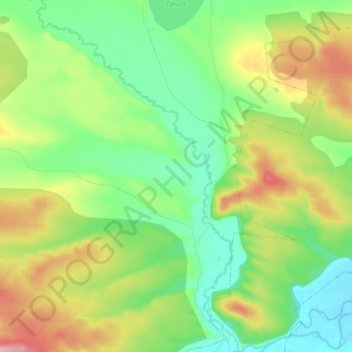
Name: Танга topographic map, elevation, terrain.
Average elevation: 900 m
Minimum elevation: 836 m
Maximum elevation: 1,026 m
Other topographic maps
Click on a map to view its topography, its elevation and its terrain.
Танга
Russland > Region Transbaikalien > Тангинское сельское поселение
Танга, Тангинское сельское поселение, Улётовский район, Region Transbaikalien, Föderationskreis Ferner Osten, 674072, Russland
Average elevation: 951 m