
Serra de São Pedro topographic map
Interactive map
Click on the map to display elevation.
About this map
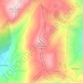
Name: Serra de São Pedro topographic map, elevation, terrain.
Location: Serra de São Pedro, Tendais, Cinfães, Viseu, Portugal (40.99620 -8.09106 40.99630 -8.09096)
Average elevation: 1,017 m
Minimum elevation: 723 m
Maximum elevation: 1,219 m