
Balclutha topographic map
Click on the map to display elevation.
About this map
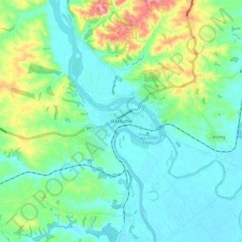
Name: Balclutha topographic map, elevation, terrain.
Location: Balclutha, Clutha District, Otago, 9230, New Zealand (-46.27780 169.69986 -46.19780 169.77986)
Average elevation: 41 m
Minimum elevation: 1 m
Maximum elevation: 152 m
Clutha District trails, hiking, mountain biking, running and outdoor activities
Other topographic maps
Click on a map to view its topography, its elevation and its terrain.