
Trohanny topographic map
Interactive map
Click on the map to display elevation.
About this map
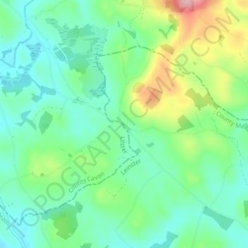
Name: Trohanny topographic map, elevation, terrain.
Location: Trohanny, Teevurcher, County Meath, Leinster, Ireland (53.86019 -6.94804 53.90019 -6.90804)
Average elevation: 173 m
Minimum elevation: 128 m
Maximum elevation: 293 m