
Sandunpura topographic map
Interactive map
Click on the map to display elevation.
About this map
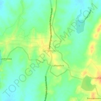
Name: Sandunpura topographic map, elevation, terrain.
Location: Sandunpura, Ampara District, Eastern Province, Sri Lanka (7.60801 81.02835 7.64801 81.06835)
Average elevation: 89 m
Minimum elevation: 74 m
Maximum elevation: 109 m
Other topographic maps
Click on a map to view its topography, its elevation and its terrain.
Manmunai North DS Division
Manmunai North DS Division, Batticaloa District, Eastern Province, 094, Sri Lanka
Average elevation: 3 m