
Thank you for supporting this site ❤️
Make a donation
Make a donation
Mund topographic map
Click on the map to display elevation.
Thank you for supporting this site ❤️
Make a donation
Make a donation
Mund
The former municipality is located in the Brig district, on the northern slope of the Rhone valley at an elevation of about 1,200 m (3,900 ft).
Thank you for supporting this site ❤️
Make a donation
Make a donation
About this map
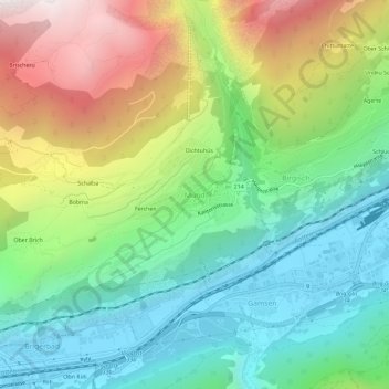
Name: Mund topographic map, elevation, terrain.
Location: Mund, Naters, Brig, Wallis, 3903, Switzerland (46.29529 7.92110 46.33529 7.96110)
Average elevation: 1,250 m
Minimum elevation: 650 m
Maximum elevation: 2,353 m
Thank you for supporting this site ❤️
Make a donation
Make a donation
Other topographic maps
Click on a map to view its topography, its elevation and its terrain.