
North Richland Hills topographic map
Interactive map
Click on the map to display elevation.
About this map
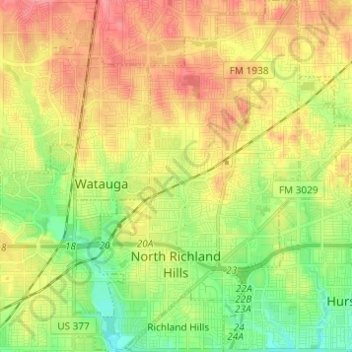
Name: North Richland Hills topographic map, elevation, terrain.
Location: North Richland Hills, Tarrant County, Texas, United States (32.80874 -97.26452 32.91181 -97.18592)
Average elevation: 191 m
Minimum elevation: 154 m
Maximum elevation: 231 m
Other topographic maps
Click on a map to view its topography, its elevation and its terrain.