
Thank you for supporting this site ❤️
Make a donation
Make a donation
Moss topographic map
Click on the map to display elevation.
Thank you for supporting this site ❤️
Make a donation
Make a donation
About this map
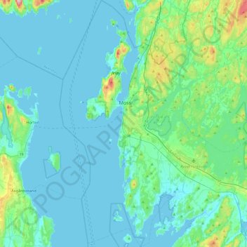
Name: Moss topographic map, elevation, terrain.
Location: Moss, Østfold, Norway (59.29388 10.53668 59.53458 10.82077)
Average elevation: 23 m
Minimum elevation: -2 m
Maximum elevation: 174 m
Thank you for supporting this site ❤️
Make a donation
Make a donation