
Mwanza topographic map
Interactive map
Click on the map to display elevation.
About this map
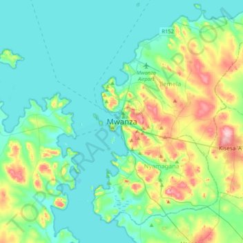
Name: Mwanza topographic map, elevation, terrain.
Location: Mwanza, Nyamagana, Mwanza, Seezone, 33214, Tansania (-2.67969 32.74144 -2.35969 33.06144)
Average elevation: 1,178 m
Minimum elevation: 1,129 m
Maximum elevation: 1,346 m
Mwanza liegt am Südufer des Victoriasees in einer Seehöhe von 1144 Metern. Die Stadt hat über 700.000 Einwohner (Stand 2012) und ist das wirtschaftliche Zentrum der Seenregion. Sie ist umgeben von Hügeln und riesigen Felsblöcken.