
Thank you for supporting this site ❤️
Make a donation
Make a donation
Leivasy topographic map
Click on the map to display elevation.
Thank you for supporting this site ❤️
Make a donation
Make a donation
About this map
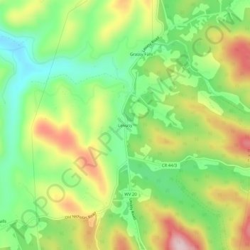
Name: Leivasy topographic map, elevation, terrain.
Location: Leivasy, Nicholas County, West Virginia, United States (38.14123 -80.71092 38.18123 -80.67092)
Average elevation: 754 m
Minimum elevation: 635 m
Maximum elevation: 917 m
Thank you for supporting this site ❤️
Make a donation
Make a donation
Other topographic maps
Click on a map to view its topography, its elevation and its terrain.