
Thank you for supporting this site ❤️
Make a donation
Make a donation
Playa Fronton topographic map
Click on the map to display elevation.
Thank you for supporting this site ❤️
Make a donation
Make a donation
About this map
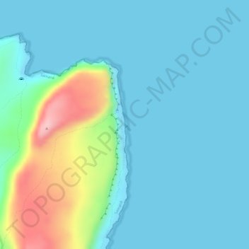
Name: Playa Fronton topographic map, elevation, terrain.
Location: Playa Fronton, Samana, Samaná, Dominican Republic (19.29528 -69.15133 19.29552 -69.15122)
Average elevation: 38 m
Minimum elevation: -1 m
Maximum elevation: 189 m
Thank you for supporting this site ❤️
Make a donation
Make a donation