
Tai'an topographic map
Click on the map to display elevation.
About this map
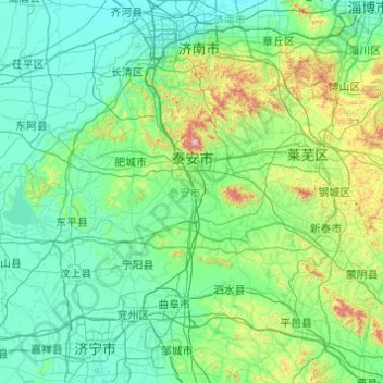
Name: Tai'an topographic map, elevation, terrain.
Location: Tai'an, Shandong, 271000, China (35.63400 116.04149 36.47769 117.99666)
Average elevation: 161 m
Minimum elevation: 20 m
Maximum elevation: 1,481 m
Other topographic maps
Click on a map to view its topography, its elevation and its terrain.